FOREGOING CONSIDERATIONS
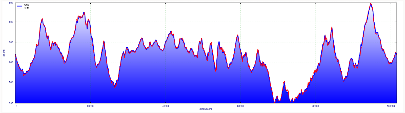
Patanegra Challenge itinerary is approximately 105 kilometers long and it counts with 4000 meters of positive elevation gain, and more or less the same of negative elevation. It’s not a precise information because measuring is very complicated in so long routes and the data can vary depending on the model of the GPS.
The GPS we use work with accuracy ranks around 6 meters, and that can sometimes be the measure of the wideness of a path. However, some information like where an intersection is or if a path goes to the right or to the left can never be wrong. Following the track installed in the GPS is very easy, since the itinerary will be in the screen marked always in the same colour, while the rest of the paths, rivers, roads and even the path the participant does while walking will appear in other colours.
For those who never used a GPS, we offer a free course (one hour of duration) that will allow the participant to get some practice with the gadgets before facing the Patanegra Challenge.
The itinerary has, like it’s been mentioned before, a few different categories, and each one of them has different peculiarities. The categories are:
- Non stop - endurance running.
- Mountain Bike.
- Hiking.
- Nordic Walking.
- Duathlon.
The itinerary remains always the same but the challenge changes for each category, since the conditions and the difficulties are different.
ITINERARY
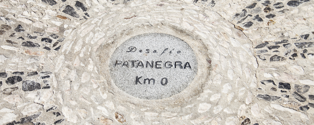
It is thought to start and finish in Santa Ana la Real, where we have located kilometer zero; but you could actually leave from any point in the circular itinerary. Santa Ana la Real seems a good place because it is located in the center of the region and from here we provide the GPS and the bag of the runner / walker / biker / hiker.
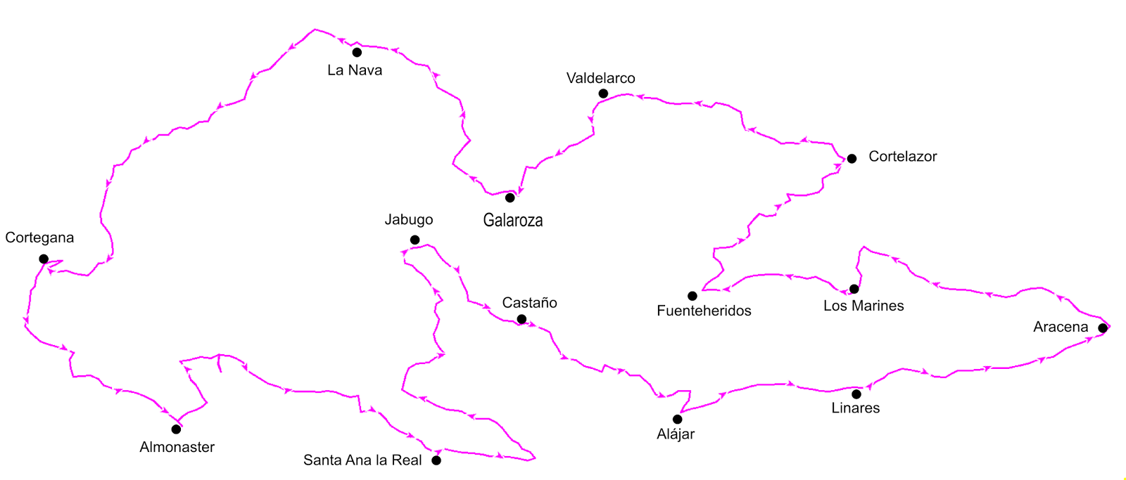
The itinerary is mainly formed by paths. There are a few roads that will just have to be crossed, with the exceptions of the entrance to Almonaster from Cortegana, where there is a section of 800 meters through a road before arriving to the town and about 80 meters near the Venta el Cruce in Santa Ana la Real. However, there are some parts of concrete walkway since the itinerary goes through 14 villages.
There are a few crossing that is worth to mention since they involve important roads, but the others are just regionals. The national roads are:
- In the way out of Aracena to Portugal, but it’s a commercial area and bridges can be found, the road that must be crossed is the N-433.
- There are two crossings at the entrance and exit of Fuenteheridos. Careful here, since these are the most dangerous ones. The road is the N-433.
- When arriving to La Nava there is a crossing involving the N-435. This one is quite dangerous too..
- Also dangerous is the crossing of the national road in the entrance to Cortegana with the N-433.
The rest of crossings in are riskless, altho we recommend to every participant to be cautious.
Most of our paths are pretty old and are surrounded by the little walls of the lands, which implies that is common to find little stones on the paths but also the beauty of the old days. Most of the paths can’t be done by car except those areas fixed for the owners of the closer lands. Some of the paths are very small and unused, and this allows the participant to get to know some of the most virgin areas, at the cost of finding a bush blocking the way from time to time.
In several occasions the participant will go uphill in the way of a very emblematic spot, such as the castle in Cortegana, or the Mosquee in Almonaster, but also the San Cristóbal (the second highest peak of the region with 896 meters), ceiling of the Patanegra Challenge. There will be more climbing to not that well-known places, but also hard, like the way from Jabugo to Castaño del Robledo, or from Linares to Aracena. You won’t find endless climbing since we do not have very high peaks, but what you will definitely not find are plains.